
The 10th Beijing International Surveying and Mapping Geographic Information Technology and Equipment Exhibition 2025
Invitation
Time : June 26-28, 2025
Location : Beijing Shougang Convention and Exhibition Center
Guest units��
• Ministry of Land and Resources
• Ministry of Environmental Protection
• Ministry of Science and Technology
• Ministry of Industry and Information Technology
• SASTIND
• China Association of Science and Technology
• The Surveying and Mapping Bureau of the General Staff
• Department of the People's Liberation Army
• China Meteorological Administration
• Chinese academy of surveying and mapping
• National Surveying and Mapping First Geodetic Survey Team
• National Remote
Sensing Center
Supported By��
• International Association of Geodesy
• International Digital Earth Society
• German Navigation Society
• Institute of Navigation
• Royal Navigation Society of the United Kingdom
• Global Chinese
Positioning and Navigation Association
Organizational Unit��
• Beijing Zhongsheng International Exhibition Co., Ltd
• Guanhui Exhibition (Shanghai) Co., Ltd
Expo Theme��Innovation, Transformation, Integration, Development.
Exhibition Profile��
In recent years, the surveying and mapping geographic information industry has developed rapidly, playing a significant role in informatization and modernization construction, and making important contributions to promoting economic growth and maintaining social stability. With the rapid development of China's economy and society, and the continuous improvement of people's living standards, the demand for surveying and mapping geographic information services in the whole society has sharply increased. It is urgent to accelerate the development of the surveying and mapping geographic information industry and enrich geographic information products. In addition, developed countries attach great importance to the development of the surveying and mapping geographic information industry, and the international surveying and mapping geographic information industry is rapidly developing, intensifying competition in the global surveying and mapping geographic information market. Driven by digital trends such as "Digital China" and "Digital City", China's geographic information industry is developing rapidly and showing a strong growth trend. At the same time, the deepening of downstream industry applications, the continuous release of market demand, and the continuous improvement of technological level have provided new impetus, new markets, and new support for the development of the geographic information industry. Under various factors, the geographic information industry is expected to continue its high-speed growth and has broad prospects for future development.
In order to thoroughly implement the Opinions on Promoting the Development of Geographic Information Industry and the National Basic Surveying and Mapping Medium - and Long Term Plan Outline (2015-2030), and implement the overall strategy of "strengthening basic surveying and mapping, monitoring geographical conditions, strengthening public services, strengthening the geographic information industry, maintaining national security, and building a strong surveying and mapping country", The 9th Beijing International Surveying and Mapping Geographic Information Technology Equipment Exhibition (CISMEXPO2025) will be held from June 26 to 28 at the Shougang Convention and Exhibition Center in Beijing. The aim is to accelerate the construction of new basic surveying, digital China, geographic monitoring and emergency surveying and mapping support, improve the deep integration development mechanism of military and civilian surveying and mapping, and build a professional exchange platform for building a modern large-scale surveying and mapping system in China.
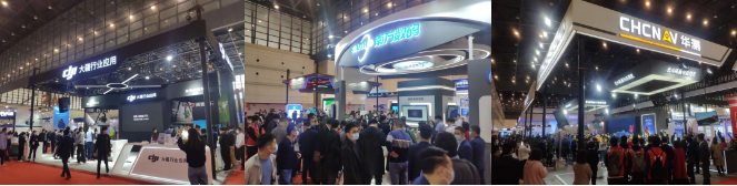
In order to thoroughly implement the "Opinions on Promoting the Development of the Geographic Information Industry" and the "National Basic Surveying and Mapping Medium and Long-term Planning Outline (2015-2030)", and implement the overall strategy of "strengthening basic surveying and mapping, monitoring the geography of the country, strengthening public services, expanding the geoinformation industry, maintaining national security, and building a strong country in surveying and mapping", the "CISMEXPO2025 Ninth Beijing International Surveying and Mapping Geographic Information Technology Equipment Exhibition" will be held again at the Beijing Shougang Convention and Exhibition Center from June 26 to 28. It aims to accelerate the construction of new basic surveying and mapping, digital China, geography monitoring, emergency surveying and mapping support, improve the deep integration development mechanism of military and civilian surveying and mapping, and build a professional exchange platform for China's modern large-scale surveying and mapping system. CISMEXPO has received attention and support from many domestic and foreign surveying and mapping instruments, 3S technology research, production, traders, and various surveying and mapping units. CISMEXPO has attracted more than 100 well-known domestic and foreign brands such as Huace, Nanfang Surveying and Mapping, DJI, NavVis, Haoyu 3D, Huolang Electronics, Patriot, Yuanshou Electric, Gelei Information, Haiou Digital, Lanhai Optics, Jueshimei, Wove Information, Qi07 Research Institute, Nanchu Beijing, Xiangtuo, Haoyu Tiandi, Tianlifa, Zhonglian Yitong, Haili Tianmeng, Shenzhoulong, Shuangbai Ailinglong, Tianchuang Dadi, Tuyang Yuanfang, Weijia UAVs, Ruibao Technology, Zhengxing Hongye, Zhongdi Yuanda, Tianyuan Ou Rui, Guangdian Electronics, Aerospace Vision, Leica Geosystems, Tianbao Geospatial Technology Co., Ltd., Ounuo Jia Technology Co., Ltd., Fushide Geospatial Technology Co., Ltd., Sojia Geospatial Technology Co., Ltd., Su Yiguang Geospatial Technology Co., Ltd., Tuopu Kong Electronic Technology Co., Ltd., Nikon Co., Ltd., Zhongtong Surveying and Mapping Technology Co., Ltd., Chaotong Surveying and Mapping Technology Co., Ltd., Canon Co., Ltd., Sinan Space Technology Co., Ltd., Lide Space Technology Co., Ltd., Teledyne Optech Pix4D and so on. The exhibition attracted nearly 10,000 professional visitors from various provinces and cities in China. During the same period, a series of high-level activities such as the National Surveying and Mapping Emergency Support Development Forum, Geographic Information Processing and Application Technology Exchange Conference, New Product Launch Conference were held.
The 2024 CISMEXPO Beijing Exhibition will uphold the international, professional and branding exhibition style, actively promote the interaction and communication between domestic and foreign producers, distributors, dealers, scientific research institutions, service agencies, surveying and mapping experts and end users in the surveying and mapping industry, and focus on displaying relevant software, hardware, system integration and solutions in the industry. It covers the technology and application of integrated land, sea, air, space and ground industries, promotes the continuous development of industry towards cross-border integration, strives to create an integrated display and communication platform for industry experts, leaders, sales and procurement, builds high-quality channels for enterprises to understand the market, communicate information, promote products, make friends, negotiate business, and wins wide recognition in the surveying and mapping industry. Now we sincerely invite all industry units to actively participate in the exhibition and conference to share the event.
Participation Goal :
1. Provide face-to-face business opportunities for enterprises and comprehensively and effectively expand product services.
2. Accurately positioning your company and image, effectively enhancing the brand awareness of the company in the industry.
3.Assist enterprises in finding the most suitable invited buyers for you, establish a wide range of agents and investment networks.
4. By engaging in in-depth conversations with industry decision-makers, achieve a company's position in the market.
5. Consolidate old customer relationships and meet new customers, stay up-to-date with the latest industry trends and trends.
6. Listen to the unique insights of regulatory authorities, corporate decision-makers, and industry experts in the industry.
7. Uncover the key factors and competitive landscape that will affect your business growth.
8. Establishing the necessary network relationships with numerous industry units for career development and moving forward together with you.
9. Establishing the necessary network relationships with numerous industry units for career development, working together with you to advance with various participation plans and promotional combinations, bringing the best promotional effects to your different budgets.
10. Lock in more target customers for the enterprise.
11. The most authoritative surveying and mapping geographic information exhibition in China provides you with the best promotional platform.
ScopeOfExhibits :
Hardware equipment��Hardware equipment includes total stations, theodolites, levels, drones, unmanned ships, aerial cameras, LiDARs, mobile measurement vehicles, measurement robots, satellite positioning receivers, laser 3D scanners, rangefinders, vertical aligners, laser pointing instruments, plotters, leveling instruments, mu measuring instruments, Beidou terminals, Beidou boards, Beidou modules, GNSS products, satellite phones, emergency communication, underground pipeline detectors Construction engineering testing instruments, non-destructive testing equipment, etc.
Software Technology��Natural resource management and investigation, geographic information, electronic maps, navigation and positioning, satellite applications, remote sensing images, location services, smart cities, intelligent transportation, road and bridge monitoring, pipeline data, ocean monitoring, real estate management, virtual and visualization technology, spatial information technology, geographic science popularization, land monitoring, spatiotemporal big data cloud platform, positioning enhancement network, indoor positioning, photogrammetry, unmanned driving Solutions and technical services for geological hazard monitoring and prediction, cloud computing, Internet of Things, big data, underground pipe gallery andpipelinenetwork,etc.
Equipment Accessories Products��Walkie talkies, radio stations, relay stations, telescopes, ranging telescopes, tripods, tower rulers, flower poles, prisms, leveling bubbles, leveling rods, steel tape measures, measuring wheels, batteries, chargers, data cables, antennas, calculators, instrument boxes, air pressure altimeters, compasses, outdoor locators, outdoor watches, solar cells, outdoor supplies, hardware tools, etc.
Charge Standard��
1. Standard booth: 9 square meters (3 m�� 3m), specially designed bare ground (starting from 36 square meters);
2. Domestic unit: ��16800 for domestic enterprises.
Foreigncompanies:$4000 Luxury Standard Exhibition:Domestic enterprise ��18800,Foreign company$4500.Bare space:��1580/�O for domestic enterprises��$400/�O for Foreign enterprises.
3.Standard Booth:Includes three display boards, negotiation tables and chairs, two spotlights, 220V/5A power sockets, carpets, and company name lintel; There are no facilities on the ground, and the management and power costs are borne by oneself.
4.Please contact the organizing committee for conference reports, technical exchanges, publication promotion, on-site activities, and other forms of promotion.
Promotion Plan��
CCTV, China Central Radio, Beijing Television, People's Daily, Beijing Morning News, Beijing Evening News, Beijing Urban Daily, Science and Technology Daily, China Surveying and Mapping News, Modern Scientific Instrument Magazine, China Surveying and Mapping Journal, Geographic Information World, Remote Sensing Information, Global Positioning System, etc.
NetworkPromotion��
Xinhua, People's Daily, China News, Global, Sohu, NetEase, Sina, Tencent, China Surveying and Mapping Network, cehui8 Surveying and Mapping Network, China Surveying and Mapping News Network, China Surveying and Mapping Instrument Network, CCID Network, China Surveying and Mapping United Network, China Geospatial Project Network, Tianle Surveying and Mapping Instrument Network, 3sNews, China Chemical Instrument Network, Surveying Instrument Network, China Measurement and Control Network, National Security Network, National Defense Technology Network, Cross border Procurement Network, 51GPS Network China Exhibition Network, Global Exhibition Network, Instrument and Meter Business Information Network, Global Drone Network, China Geographic Information Industry Network, Road and Bridge Technology Network, China Geographic Information Network, Modern Scientific Instrument Network, GIS Network, GPS World Network, Northwest Mining Network, Coordinate Network, Geoinformation Network, China Mineral Processing Technology Network, Geographic Information Technology Network, High end Equipment Network, China Shipbuilding Network, IoT China, QC Testing Instrument Network Global Hardware Tools Network, China Safety Production Business Network, Industrial Control China, China Police Equipment Network, China Special Equipment Network, China Aircraft Network, China General Aviation Network, etc.
Professional Audience Invitation��
The main fields come from: land, environment, surveying and mapping, detection, monitoring, earthquake, urban construction, transportation, health, meteorology, civil affairs, agriculture, forestry, electricity, underground construction, geographic information, remote sensing, archaeology, 3S, GIS, GPS, RS, water conservancy, military industry, maritime police, security, real estate, information centers, search and rescue, border defense, coastal defense, civil defense, air traffic control, aviation, aerospace, airports, national defense, satellite, judiciary, transportation Tourism bureaus, environmental protection, maritime, technology, customs, nuclear industry, industry and information technology, ports, railways, prisons, food, marine, medicine, taxation, medical, Red Cross, foundations, postal, telecommunications, finance, securities, banks, insurance companies, weapons, ships, universities, petroleum, petrochemicals, supervision, diplomacy, embassies, education, urban security, trade, professional colleges, disaster prevention and control units, as well as Japan and South Korea Surveying and mapping management agencies and related research consulting units in countries and regions such as the United States, Canada, European countries, Taiwan, Hong Kong, and the United Nations will directly mail 20000 invitations and 100000 tickets to organize professional visitors to visit the exhibition. Gathering authoritative surveying and mapping institutions to jointly create a surveying and mapping geographic information exchange event.
Organizing Committee of 2025 Beijing Surveying and Mapping Geoinformation Exhibition��
Contact person: Mr. Pan
Mobile ��+86-188-0182-3515 ��Same WeChat account��
Mobile ��+86-132-4080-0242 ��Same WeChat account��
Business Q Q��916984267 , 861727071
Email��916984267@qq.com , 861727071@qq.com
Address: No. 225, Block C, Haiyue City, Liangxiang, Fangshan District, Beijing.
Conference website : http://www.cismexpo.com/beijing

��Ȩ���У��������ʲ�������Ϣ����װ��չ������ί��
��ϵ�ˣ������� �ֻ�/�� ��132-4080-0242 ��ICP��20019626��-4
����QQ��916984267 �� �䣺916984267@qq.com